Chattahoochee RiverLands Greenway Trail
Landscaping & Beautification > Chattahoochee Riverlands Greenway Trail
An Industrial District Bordered by a River
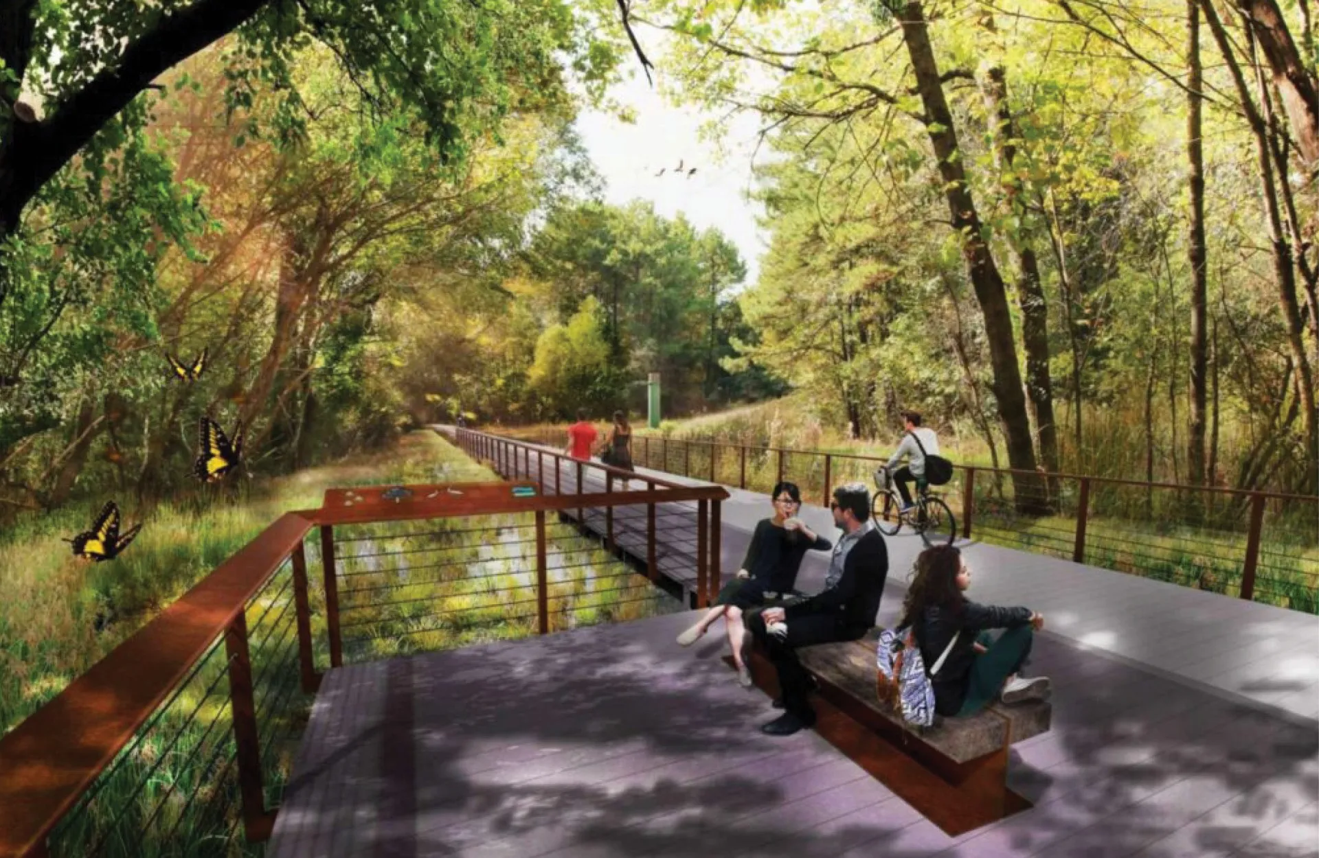
About the Chattahoochee RiverLands Greenway Trail
For more than 30 years, Trust for Public Land (TPL) has led the effort to create a continuous, multiuse path along the Chattahoochee River where residents and visitors alike can fish, hike, paddle and enjoy Georgia’s most famous river. Through these efforts, TPL has already helped preserve more than 18,000 acres of land and 80 miles of riverfront for public use.
The Chattahoochee RiverLands project is an initiative of TPL to help envision a plan for 100 miles of trails and parks along the river. From 2018 through 2022, the Chattahoochee Working Group engaged on a regular basis to better understand Chattahoochee-related topics, agendas and initiatives, and to conceive a master plan for the RiverLands. The final report represents an aspirational vision for the Chattahoochee RiverLands, developed in collaboration with current-day stewards, paddlers, anglers, volunteers and citizens. Following the creation of the master plan, the group engaged in the development of Design Guidelines with the goal of developing a singular user experience through the multiple jurisdictions and varied landscape the RiverLands will traverse.
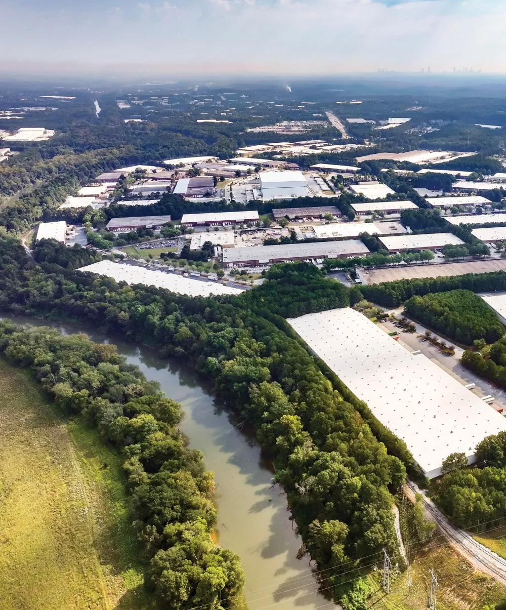
The Future of the RiverLands Along the Fulton Industrial District
At present, TPL is exploring grant opportunities to fund the next phase of design for the trails that will run alongside the 11 miles of river that border the western side of the Fulton Industrial CID.
To learn more about the entire Chattahoochee RiverLands initiative, click the button below.
To view and download a map that includes the 11-mile portion of the Greenway Trail running through the district, click the button below.
News & Media
Urbanize Atlanta
March 13, 2023